Understanding how aquatic life was arranged across rivers and lakes helped shape conservation planning. Early work by Abell et al. (2008) defined 426 ecoregions, creating a global map that linked hydrology with fish biogeography.
Researchers then used the FreshVerts v1.0 database to analyze data for over 23,000 vertebrates. That resource made it easier to compare patterns of biodiversity and range across regions.
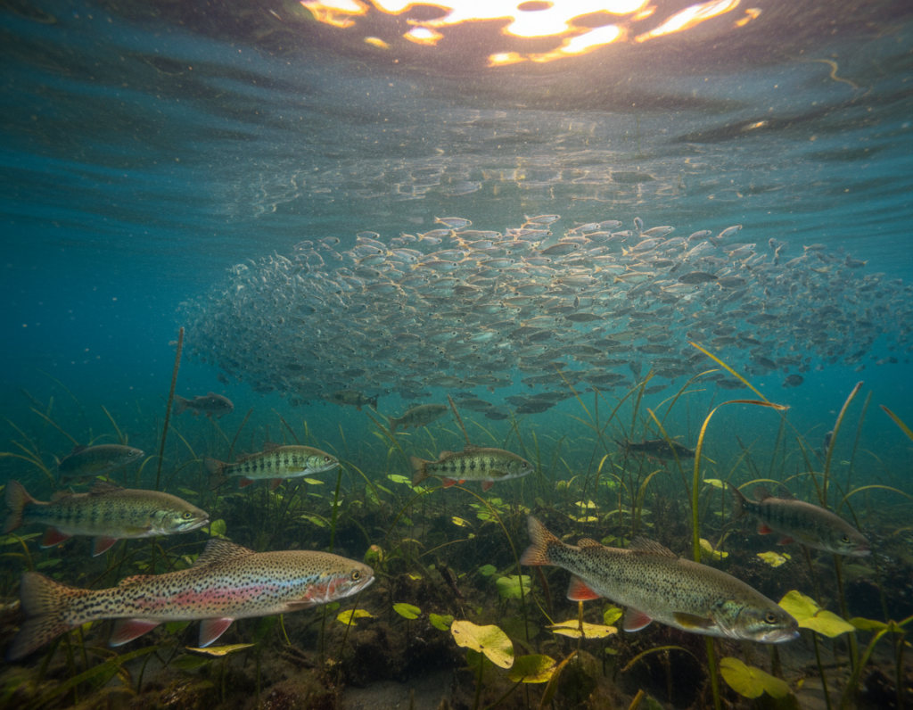
Although these ecosystems covered under 1% of Earth’s area, they supported a large share of known life. Scientists noted that nearly a third of all vertebrates relied on these waters at key life stages.
The study of these patterns guided work at multiple scales. It helped prioritize conservation, refine models, and account for rapid change in taxa, including hundreds of new fish descriptions each year.
Understanding Freshwater Species Distribution
Mapping aquatic life has long helped ecologists spot shared biogeographic patterns across continents. Early work framed ecoregions as large units that contain distinct assemblages of natural communities and life forms.
Terrestrial ecoregions often relied on topography, climate, and vegetation. By contrast, river and basin dynamics shape where fish and aquatic communities occur. This hydrological focus matters for conservation planning at multiple scales.
Recent assessments show that these waters are more degraded by human activity than many land or ocean areas. That finding increases the urgency to combine high-quality data with regional planning to protect biodiversity and population ranges.
- Mapping helped identify natural boundaries formed by climate and terrain.
- Ecoregions represent original community extents before major land-use change.
- Integrating fish data into ecoregional frameworks enables cross-taxa biogeography comparisons.
Understanding ecology and evolution of aquatic groups requires historical context plus current stressor information to guide effective conservation planning.
The Role of Ecoregions in Biodiversity Mapping
Ecoregions translate river basins and lakes into a practical map for conserving aquatic life. They let managers link ecological patterns to planning at relevant scales.
Defining Ecoregional Boundaries
The FEOW framework, published in 2008, divides the global land surface into 426 spatial units. Delineation relied on the observed ranges of more than 13,400 fishes and basin outlines from HydroSHEDS.
Experts found that aligning limits with watershed boundaries captured shared occurrence patterns. Workshops with regional fish experts validated catchment-based boundaries as a natural way to map presence and ranges.
Global Biodiversity Prioritization
These ecoregions now guide biodiversity conservation and conservation planning worldwide. Synthesizing continental patterns helps researchers prioritize areas that lack protection.
- FEOW units support targeted conservation across aquatic and land realms.
- HydroSHEDS basin data provides consistent hydrographic variables for mapping.
- Catchment-based mapping improves the accuracy of range and richness assessments.
By framing biogeography around basins, planners gained actionable information for long-term protection and for tracking change across regions.
Freshwater Species Distribution and Catchment Dynamics
Catchment processes steer downstream impacts that shape where aquatic life occurs in river networks. These dynamics control how pollutants, sediments, and nutrients move and where populations persist.
Catchments are essential management units. Unlike terrestrial ecoregions that cross multiple basins, basin-scale planning aligns with watershed boundaries and the natural flow of water. The FEOW framework formalized this by mapping many species across 426 hydrographic units.
Research shows latitudinal gradients in species richness exist, yet alignment between aquatic and land biodiversity is often weak. That mismatch means terrestrial data cannot reliably proxy for aquatic conservation needs.
- Catchment connectivity drives movement and occurrence of fish and other groups.
- Downstream propagation of pollution makes catchment size and land use critical variables.
- Catchment-based mapping improves planning and helps predict change in range and richness.
For managers, integrating catchment-focused data with regional planning is vital. See a detailed review of catchment approaches in catchment-based mapping.
Influence of Climate on Aquatic Habitats
Rising temperatures are already reshaping aquatic habitats around the globe. Observed warming tightened thermal limits and changed where many organisms could persist.
Temperature Alterations and Range Shifts
The IPCC Fifth Assessment Report recorded a global mean increase of 0.85°C between 1880 and 2012. That warming has been linked to shifts in range and to declines in sensitive populations.
For strictly aquatic life, even small changes in water temperature set hard tolerance limits. Those limits alter local assemblages and affect overall biodiversity and species richness.
- Temperature changes drive northward or upstream range shifts for many groups.
- Minor thermal shifts can reorganize community composition and reduce presence of cold-adapted fishes.
- Mid-century projections under RCP4.5 forecast continued warming, stressing river catchments across Europe and beyond.
Effective conservation planning must include thermal projections and monitoring data to anticipate range change. Integrating climate variables improves management at multiple scales and helps prioritize areas for protection.
Thermal Response Curves for Freshwater Species
Thermal response curves summarize how an organism’s occurrence changes across a temperature gradient, highlighting an optimum where presence peaks. Researchers commonly approximate these curves with a unimodal Gaussian shape to find the preferred temperature for a given group.
In a large study, scientists evaluated 577 European freshwater species using generalized additive models to link occurrence to mean and maximum temperatures. Warming tolerance was then calculated as the difference between the maximum recorded temperature of occurrence and the preferred temperature. Safety margins measured how far preferred temperatures exceeded the average temperature within a species’ current range.
“Validated thermal curves help pinpoint taxa most at risk from rising temperatures,” the study noted.
- TRCs typically follow unimodal Gaussian distributions and identify temperature optima.
- Statistical validation with AUC and TSS ensured high predictive performance across river catchments.
- These models inform conservation by revealing which fish and other groups face narrow thermal buffers.
Implication: Robust thermal models give managers clear information to prioritize areas and actions as climate change alters habitat temperatures and ranges.
Taxonomic Groups and Their Habitat Requirements
Different tetrapod groups show distinct links between life-history needs and aquatic habitat types.
Freshwater Mammals
The FreshVerts v1.0 database now records 127 mammal taxa that rely on water to complete key life stages. This update broadened previous assessments and improved regional planning data.
Avian Dependencies
Bird dependence on aquatic areas is complex. Researchers applied a conservative approach and found that only one-third of kingfisher groups qualify as obligate water users.
Reptile Habitat Generalists
Careful filtering produced a list of 639 reptiles whose life cycles need aquatic habitat. Amphibian coverage is especially extensive, with 5,089 taxa and 15,885 ecoregional records in the same database.
- Clear criteria ensure inclusion only when breeding or feeding requires water.
- Taxonomic groups are separated to guide targeted conservation and mapping.
- These counts improve biogeography and range information across river basins and areas.
Understanding ecology evolution of these groups helps match conservation actions to where presence and occurrence are most likely.
Freshwater Fish Species and Biogeographic Patterns
An expanded checklist of fishes reshaped understanding of how many groups occur across river basins. The original FEOW list contained 13,802 entries, and the 2022 FishBase update added 4,027 more names.
Researchers then compiled spatial data from multiple sources. They retrieved 1,386 records from the IUCN Red List and 1,162 point records from GBIF. Bibliographic searches supplied reliable information for another 848 taxa.
- Data integration filled major gaps and improved range mapping across 426 ecoregions.
- FishBase remained the primary open-access source for habitat classification and trait data.
- Taxonomic revisions removed 1,206 redundant entries to tighten the final database.
“Combining repositories and literature provided a far richer picture of biogeography and richness patterns.”
Implication: This integrated approach gives managers better information for fish conservation and for tracking change in riverine biodiversity at multiple scales.
Tetrapod Dependence on Aquatic Environments
Spatial analysis showed the breadth of tetrapod dependence on aquatic environments across global ecoregions.
The study identified 6,618 freshwater-dependent tetrapod species by intersecting 426 ecoregions with mapped ranges. Analysts used the R package ‘sf’ to calculate overlaps and to keep spatial results consistent and reproducible.
To ensure meaningful links, the team discarded intersections that covered less than 10% of a species’ range or less than 10% of an ecoregion’s area. This threshold reduced spurious records and improved the quality of occurrence information.
“Focusing on extant and probably extant taxa strengthened the reliability of the final dataset.”
- The analysis included mammals, birds, reptiles, and amphibians that rely on water for breeding or feeding.
- Using standardized spatial methods produced robust biogeography and range outputs.
- Results provide actionable data for conservation planning across river basins and related areas.
Implication: These findings highlight the need to protect aquatic habitats that support diverse tetrapod populations and to integrate this information into broader biodiversity and climate planning.
Modeling Species Presence and Absence
Statistical models translate field observations into maps of likely occurrence across watersheds.
In a Maryland study, researchers built presence/absence models for 30 stream fish using watershed attributes. They used conditional random forests (cRF) to link land-cover, ecoregion, and other environmental variables to the probability of presence.
Statistical Approaches to Occurrence Probability
cRF models proved effective at capturing non-linear relationships between predictors and fish occurrence. Model evaluation used Kappa and AUC scores.
Seventeen of the modeled taxa showed substantial agreement between observed and predicted values. That result improved confidence in maps that guide habitat-based conservation planning across the Chesapeake Bay watershed.
“Predicting probability of presence helps identify suitable habitat and prioritize areas for action.”
- Researchers produced presence/absence outputs for 30 taxa.
- Density category models for four representative groups identified high- and low-density locations.
- These methods strengthen species distribution modeling where complex watershed variables shape occurrence.
For methodological context, see applications of ecological niche methods in related work: ecological niche methods.
Environmental Variables Shaping Distribution
Key physical features of a basin often explain more variation in occurrence than nearby land use. In the Maryland study, ecoregion, drainage density, and watershed area were the top predictors for 27 of 30 fish.
Land cover metrics, like percent impervious surface or row crop cover, proved important for only three taxa. That result shows that local development does not always control range or presence.
To avoid model bias, researchers removed slope and elevation because these correlated strongly with longitude. This step improved statistical robustness and clarified which variables truly shaped patterns.
Watershed indicators such as average annual precipitation and soil sand content were retained as key predictors. These variables helped build accurate, transferable models for predicting fish occurrence and richness across multiple landscapes.
“Natural landscape features, more than some land-cover measures, drove predictive performance in most models.”
- Primary drivers: ecoregion, drainage density, watershed area.
- Limited land-cover role: impervious surface mattered for few groups.
- Key watershed indicators: precipitation and soil sand content.
Implication: Conservation planning should prioritize catchment-scale context and hydrographic variables when assessing biodiversity and planning actions across regions.
Impact of Anthropogenic Stressors on Biodiversity
Human land-use change has become a leading driver of ecosystem loss and altered biogeography in riverine areas. These changes reduce habitat connectivity and change how communities form across catchments.
Land use and habitat fragmentation fragment corridors and limit the ability of many organisms to track suitable climate and habitat shifts. Small streams are particularly vulnerable; research shows that fish assemblage integrity declines as human stress rises. Fragmentation also promotes homogenization, where a few tolerant groups replace diverse local assemblages.
Land Use and Habitat Fragmentation
Conversion of natural land cover for agriculture, roads, and urban growth severs movement routes and reduces available range. Populations become isolated, and local richness falls as sensitive taxa disappear.
Pollution and Downstream Propagation
Pollution moves with flow, amplifying impacts downstream. Nutrient runoff, sediment, and chemical loads from altered catchments degrade habitat quality and lower presence of many fish species.
- Anthropogenic stressors drive ecosystem degradation and loss of biodiversity.
- Fragmentation prevents tracking of climate-driven range change and raises extinction risk.
- Downstream propagation of pollutants magnifies harm across river networks.
“Addressing land use and pollution together is essential to halt ongoing homogenization and support effective conservation.”
Data Integration and Spatial Frameworks
Integrating multiple spatial datasets created a unified framework that linked catchment maps to taxon-level records.
The FreshVerts v1.0 database, released under CC-BY 4.0 on figshare, provided the core resource for mapping global patterns. It bundles one shapefile of 426 FEOW polygons and four tables with ecoregion intersections and diversity metrics.
Researchers merged records from GBIF, IUCN, and FishBase to build 96,129 ecoregional population records. Using the R package ‘sf’ ensured consistent spatial calculations across FEOW units.
- Structure: a shapefile, four tables, and FEOW_ID keys for reproducible analyses.
- Scope: mapping 23,130 vertebrate taxa and thousands of ecoregional links.
- Utility: the framework supports cross-scale biogeography, range modeling, and conservation planning.
Implication: This harmonized approach gives managers reliable information to track change, test variables, and prioritize areas for long-term conservation.
Challenges in Mapping Freshwater Biodiversity
Translating riverine complexity into usable maps requires methods that respect branching channels and connected basins.
Dendritic networks do not fit standard point‑to‑grid mapping. That mismatch forces analysts to adopt catchment-based approaches and custom workflows.
Many taxa lack comprehensive spatial records in major repositories. Researchers must do bibliographic searches and consult experts to fill gaps.
- Branching river geometry needs different analytical tools than terrestrial grids.
- Incomplete data and rapid new fish descriptions make databases hard to keep current.
- Varying definitions of water-dependent groups create inconsistent assessments.
- Range maps that misalign with basin outlines can cause false attributions without strict validation.
Overcoming these obstacles is essential for reliable conservation planning and for maps that reflect real patterns of occurrence and richness.
“Rigorous validation, expert review, and catchment-aware methods improve the accuracy of biogeography products.”
Conservation Planning for Aquatic Ecosystems
Protecting aquatic assemblages needs management tied to catchment boundaries rather than arbitrary political lines. Catchment-Based Approach (CaBA) aligns actions with natural watershed flow and supports more effective conservation planning.
Large-scale predictions of species distribution and range change must combine natural variables with human stressors. Integrating thermal response curves and climate projections helps managers assess how temperature shifts will alter presence and richness of fish and other taxa.
Databases like FreshVerts v1.0 provide the spatial information needed to spot priority areas and to target biodiversity conservation where it will be most efficient.
- CaBA ties management to watershed units for coherent action across river networks.
- Large-scale models reveal priority areas that account for both natural variables and human impacts.
- Underrepresentation of these ecosystems in protected areas calls for targeted planning and new conservation tools.
“Strategic, catchment-focused planning yields better outcomes for populations and habitat across regions.”
Successful conservation planning works across scales. It uses robust data, links thermal models to climate scenarios, and focuses on areas where conservation can most effectively secure long-term diversity and range stability.
Future Trends in Freshwater Ecology
Advances in genomics and remote sensing are reshaping how researchers forecast aquatic community responses to warming and habitat loss. Integrating genetic data with spatial models will help reveal adaptive potential and refine species distributions at finer scales.
The ongoing build-out of global databases will improve access to consistent data. Combined with eDNA monitoring and satellite products, managers will get faster, richer information on presence and range change.
Key directions include:
- Linking genomic markers to environmental variables to predict adaptive capacity for many species.
- Scaling eDNA and remote sensing to detect rare fishes and track assemblages across regions.
- Standardizing methods through international collaboration to improve taxonomic groups’ records and comparability.
- Focusing long-term research on fragmentation effects to safeguard population connectivity and richness.
Implication: These trends point to a more data-driven, technology-enabled approach to conservation, where timely information guides actions across catchments and scales.
Conclusion
Clear, comparable data form the backbone of effective management for rivers and connected basins.
Using comprehensive resources like FreshVerts v1.0 helps guide ecology evolution studies and targeted fish conservation. Accurate maps and validated thermal models improve understanding of range change and of where action will be most effective.
Meeting mapping challenges requires ongoing data collection, new monitoring tools, and international collaboration. Protecting catchments and their inhabitants depends on coordinated plans that link science, policy, and funding to deliver real biodiversity conservation outcomes.